Daniels Area
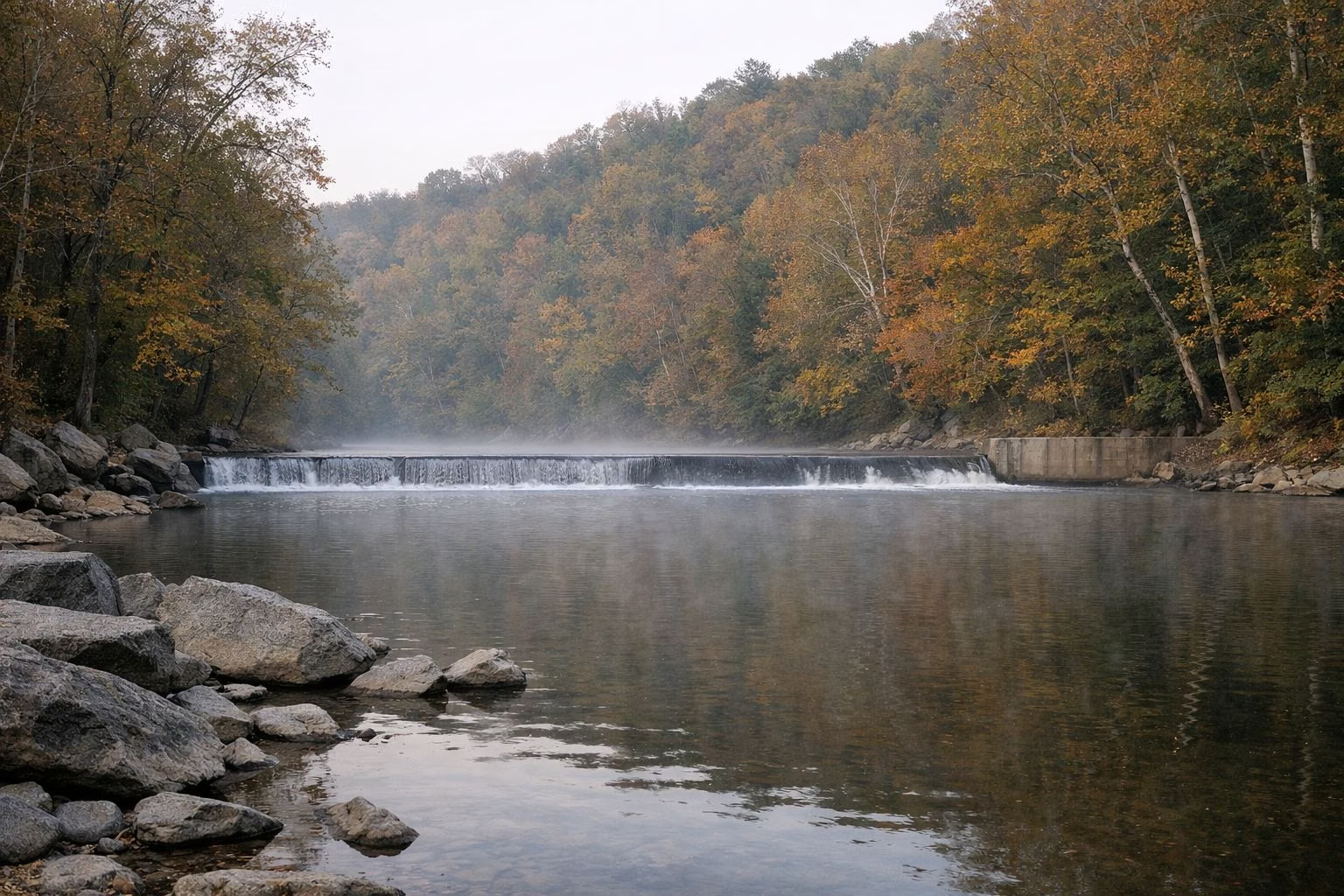
The Daniels Area is the quiet, largely undeveloped part of Patapsco Valley State Park, at 2090 Daniels Road in Ellicott City. It centers on Daniels Dam, which backs up about two miles of flat water for paddling, and on the ruins of the old mill town of Daniels, destroyed by Tropical Storm Agnes in 1972. Anglers come for smallmouth bass and spring trout, and hikers for the Old Main Line Trail and the Camel's Den. It is open from 9 a.m. to sunset, and the trailhead lot closes when full on busy weekends.
Daniels at a Glance
How to Get There
Take Route 29 north to its end at Route 99 (Old Frederick Road/Rogers Avenue), turn right on Rogers Avenue to the traffic circle and take the third exit onto Old Frederick Road. Go about half a mile, turn left on Daniels Road and drive about a mile to the parking area by the dam. (DNR's Daniels Dam page describes this turn without the traffic circle, so check a map app for the last mile.) From the Hollofield Area, take Route 40 west to the second light (Rogers Avenue), turn right, follow Rogers Avenue to Old Frederick Road, turn right, then left onto Daniels Road.
There is also trail-only access from Alberton Road on the Baltimore County side of the river.
Daniels Dam
The dam once supplied 400 horsepower to canvas and denim mills and sold surplus electricity to Baltimore Gas and Electric. Today it has a fish passage and a display about fish spawning in the river and how the fish ladder works. As at every dam on the Patapsco, all activity is prohibited within 300 feet of it, so no fishing, swimming or paddling in that zone. DNR has published a feasibility study on the dam's future, linked from the Daniels page.
Paddling
Paddlers can use this stretch all year. The dam backs up about two miles of flat water even when the river is low. When the river runs high, paddlers can travel about 4.7 river miles from Woodstock Road (Route 125) down to Daniels. A soft launch sits just above the dam. See Swimming, Tubing & Paddling.
Fishing
Fishing is open above and below the dam, outside the 300-foot zone. Smallmouth bass are here all year, and rainbow and brown trout are stocked in spring in this put-and-take area. You can cast into the swift water below the dam a few minutes from your car, or paddle upstream and fish on the float back. See Fishing.

The Mill Town
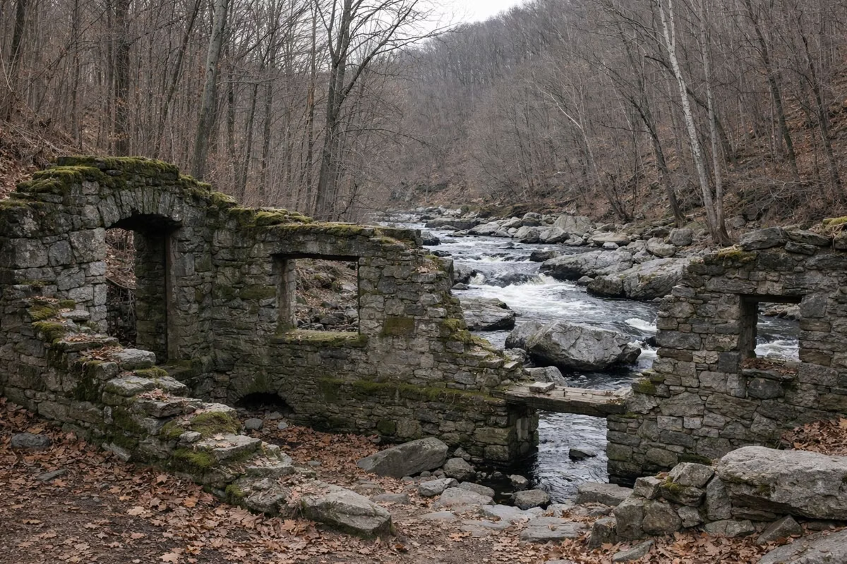
Daniels began in the 1800s as Elysville and was later called Alberton. Its cotton mill made canvas tents for the Union during the Civil War. The C.R. Daniels company took over in the 20th century and gave the town its name. At its peak around 1915, the mill employed 400 workers and ran 14,000 spindles. The company town had churches, a general store, schools, a library, a bowling alley and its own fire brigade. The company demolished most of the housing in 1968, and Tropical Storm Agnes destroyed the mill in 1972.
The surviving James A. Gary Methodist Church and the original mill site are private property. Do not trespass.
Hikes
Old Main Line Trail: DNR lists it as the single trail in the Daniels Area. It follows the river upstream on the 1831 route of the B&O Railroad. Part of that line was bypassed by a short realignment in 1838, and the whole line was bypassed in 1907. Bridge piers from the 1838 realignment show near the dam and about half a mile upstream.
Camel's Den loop (2.5 miles): from the parking lot upstream of the dam, a side trail at 0.2 mile leads to the Camel's Den, a small natural cave. DNR notes that Native Americans used caves like it on hunting and gathering trips. The loop then climbs steeply to a dry ridge of chestnut oak, hickory and mountain laurel with views of the river, drops back to the valley, and returns 0.9 mile on the old B&O railbed, where original stone track sleepers are still visible. DNR calls it one of the least traveled trails in the valley.
Alberton hike (3.6 miles): from the Alberton Road lot, past a gate (park before it), along the abandoned road to the burned-out St. Stanislas Kostka church, the vanished neighborhood of Guilford, views of the Daniels factory across the river (best from late fall to early spring), and a Pentecostal church ruin. Use caution around ruins.
Grills, Dogs and Swimming
Grills are not allowed at Daniels; the nearest designated picnic area is at Hollofield. Dogs are welcome throughout the Daniels Area on a leash; clean up after them. Unguarded swimming is allowed except within 300 feet of the dam. Watch for swift currents and sharp stones.
Daniels Area FAQ
Where is the Daniels Area of Patapsco Valley State Park?
At 2090 Daniels Road, Ellicott City, MD 21043. Take Route 29 north to its end, follow Old Frederick Road to Daniels Road, and drive about a mile to the lots by the dam.
Can you kayak at Daniels?
Yes, all year. The dam backs up about two miles of flat water, and there is a soft launch just above the dam. Stay at least 300 feet from the dam itself.
What fish are at Daniels Dam?
Smallmouth bass all year, plus rainbow and brown trout stocked each spring. Fishing is closed within 300 feet of the dam.
Where is the Camel's Den?
In the Daniels Area. Start at the parking lot upstream of the dam; after about 0.2 mile, a spur trail to the left crosses a small stream to the cave.
Can you grill at the Daniels Area?
No. Grills may be used only in designated picnic areas; the closest is in the Hollofield Area.