History of Patapsco Valley State Park
Patapsco Valley State Park is Maryland's oldest state park. It began in 1907 as the Patapsco Forest Reserve, when Catonsville farmer John Glenn donated the first 48 acres to the state. Today it covers 16,043 acres along 32 miles of the Patapsco River at the edge of Baltimore's suburbs, with eight developed recreation areas. The valley it protects was one of early America's industrial corridors: the site of some of Maryland's first mills and factories, America's first common-carrier railroad, and what is believed to be the world's first underwater hydroelectric plant.
The Park at a Glance
Before the Park
Native Americans used the valley for centuries. DNR's history guides say the Piscataway and the Susquehannock both hunted and gathered here, sometimes sheltering in caves like the Camel's Den near Daniels. Captain John Smith explored and mapped parts of the Patapsco in 1608.
Colonists brought iron and mills. Caleb Dorsey built a forge at Avalon in the 1760s; DNR credits the Dorsey Forge with the first crowbars in colonial America, and the valley's first two flour mills date to 1761 and 1766. In 1811 the Union Manufacturing Company opened Maryland's first textile mill at what is now Oella, then the nation's largest cotton works. DNR's list of valley firsts also names Benjamin Banneker of Ellicott's Mills, in 1792 the first Black astronomer and almanac publisher in America.
The Railroad Valley
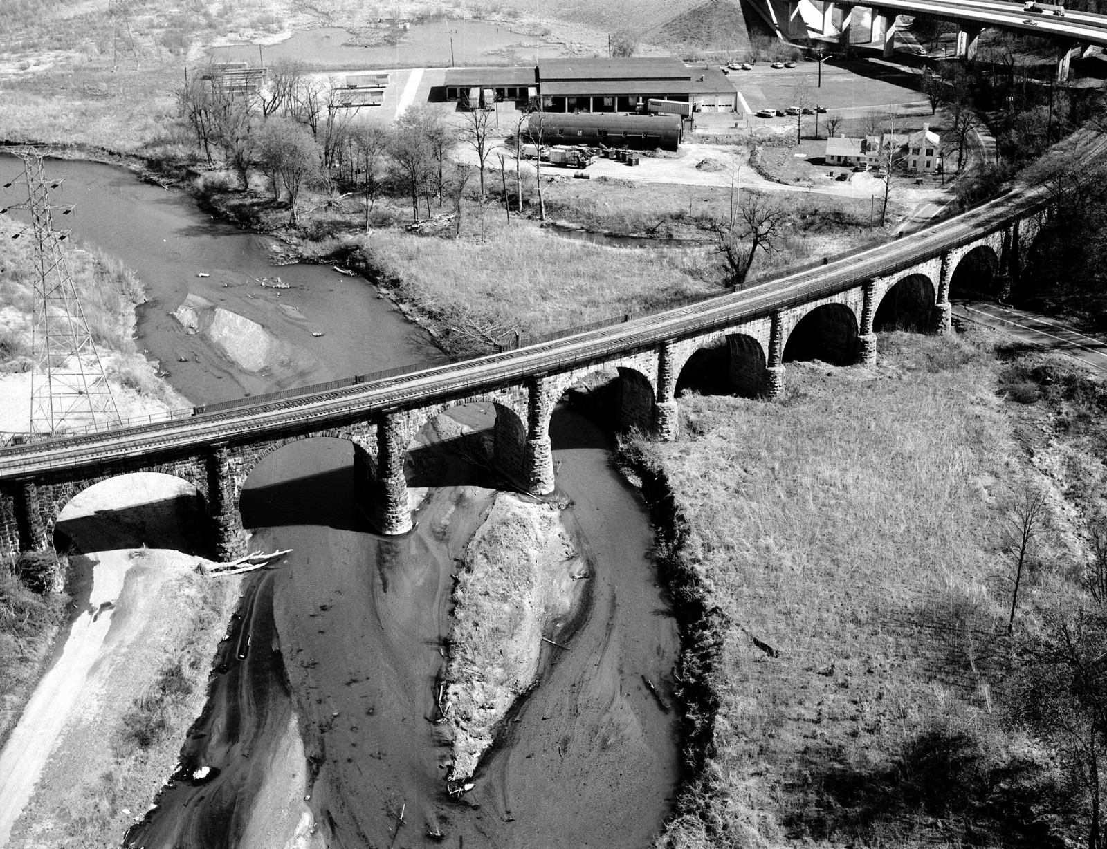
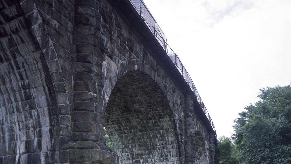
In 1830 the Baltimore & Ohio, America's first commercial railroad, ran its Old Main Line up the valley from Baltimore to Ellicott's Mills. Engineers built in stone to last: the Carrollton Viaduct of 1829, the Patterson Viaduct at Ilchester, and the Thomas Viaduct, finished in 1835 and still carrying trains. Relay, at the viaduct's north end, was the first town created by an American railroad, and in 1833 Andrew Jackson became the first sitting president to ride a train, from Ellicott City to Baltimore.
Mill towns grew along the river: Avalon, Orange Grove, Ilchester, Oella and Daniels. Floods were the constant threat. The flood of 1868 destroyed the Avalon Iron and Nail Works and the village of Avalon.
Maryland's First State Park
Fred Besley, who became Maryland's first State Forester in 1906, encouraged public use of the Patapsco Forest Reserve, established in 1907. The same year, Bloede Dam began making electricity a mile above Orange Grove. In the 1910s and 1920s, Baltimore families camped all summer along the Cascade Trail and commuted to work by train.
In the 1930s, the Civilian Conservation Corps planted trees and built trails, campsites and the cut-stone shelters still used at Hollofield. Its Camp Tydings at Avalon became, in 1941, the nation's first government-approved camp for conscientious objectors.
Agnes and the Modern Park
The park grew in the 1950s. Then, on June 21, 1972, Tropical Storm Agnes sent the river as much as 30 feet above normal, destroying every park facility on the valley floor along with the mill at Daniels. Rebuilding followed, and Maryland's Program Open Space kept adding land. A new county sewer line after Agnes cleaned up the river, and most of its dams have since been removed, so shad and herring can spawn upstream again for the first time in about 150 years.
Patapsco Today
The park is run by the Maryland Park Service, part of the Maryland Department of Natural Resources. Volunteers help with almost everything, from rangers and naturalists to a mounted patrol, trail crews and camp hosts. Offutt Johnson, who turned the last Avalon stone duplex into the park's history center, also organized the Friends of Patapsco Valley State Park. A stakeholder-led master plan, coordinated by the Center for Watershed Protection with DNR, is being developed to make the park more resilient to floods and climate risks.
Explore the areas: Avalon, Hollofield, McKeldin, Hilton, Pickall and Daniels.
History of Patapsco Valley State Park FAQ
What is the oldest state park in Maryland?
Patapsco Valley State Park. It was founded in 1907 as the Patapsco Forest Reserve.
How big is Patapsco Valley State Park?
16,043 acres along 32 miles of the Patapsco River, with eight developed recreation areas, according to Maryland DNR.
Who runs Patapsco Valley State Park?
The Maryland Park Service, part of the Maryland Department of Natural Resources.
What happened to Patapsco in 1972?
Tropical Storm Agnes flooded the valley on June 21, 1972, raising the river up to 30 feet above normal in places and destroying the park's facilities on the valley floor.